Team replaces, repositions inlet channel markers
The buoys are back!
Boaters navigating the Sebastian Inlet Channel may notice that three channel markers are back in position and providing guidance along the oftentimes treacherous waterway.
Land and Sea Surveying, a contractor for the Sebastian Inlet District, hit the water on December 1, replacing red marker 2A, repositioning red marker 4 and resetting green marker 3A. Two more markers (red 2 and green 23) will be repaired later this month.
District officials wasted no time acting after receiving reports that markers were missing or out of alignment.
“We worked quickly to identify missing and wayward channel markers and initiated a strategy for replacing them as soon as possible,” says Sebastian Inlet District Executive Director James Gray. “Our charter clearly states that safe navigation is one of our critical functions.”
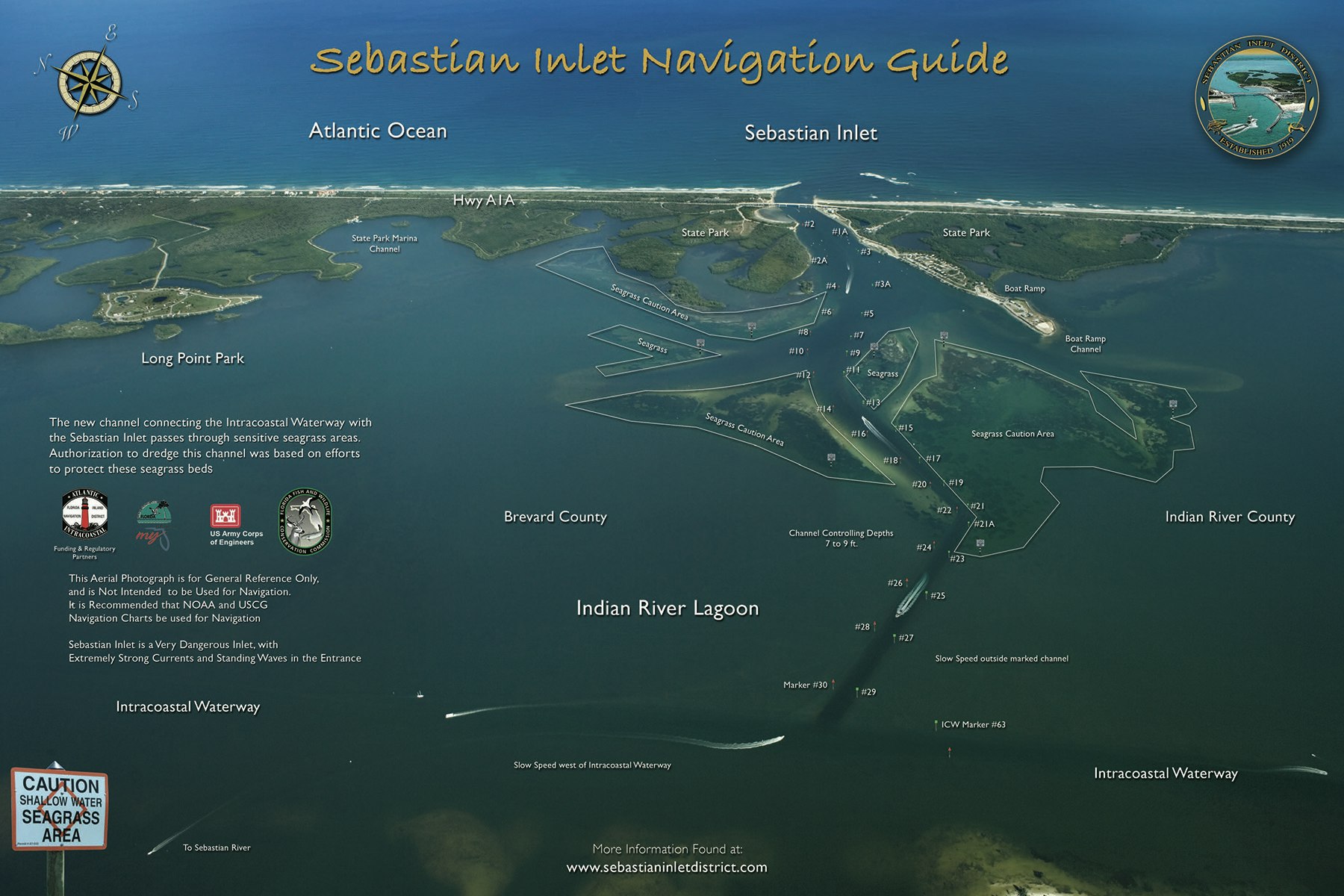
The Inlet markers identify the busy 3,120-foot navigation channel that connects the Indian River Lagoon and the Atlantic Ocean. The unlighted markers, also called daybeacons, mark the channel that the District maintains to be 150 feet wide and a minimum of nine feet deep.

There’s also an environmental angle: Channel markers help prevent boaters from veering from the deeper water and into the nearby shallows that can damage propellers, but they also help protect the Sebastian Inlet shoals on the west side of the bridge. Seagrass beds on the shoals are a veritable Club Med for shrimp, blue crabs, and juvenile fish. Seagrasses are vitally important to the health of these species and to predators relying on them for food.
While downed channel markers along the Intracoastal Waterway (ICW) in the Indian River Lagoon are maintained by the US Coast Guard and Florida Fish and Wildlife Conservation Commission (FWC), the Sebastian Inlet District is responsible for maintaining the channel and markers along the Sebastian Inlet Channel. The District also periodically dredges the channel to maintain its navigability. The Florida Inland Navigation District (FIND) works with the US Army Corps of Engineers (USACE) to maintain channel depth of the ICW.
The District offers free downloadable Sebastian Inlet Navigation Guides to help chart your course. Waterproof copies are available at the Sebastian Inlet District offices and at both State Park Ranger Entry Stations.
https://www.sitd.us/files/cdd3fd1a9/Final+SITD_Brochure_021508_Inside.pdf