Navigation
Welcome to our Navigation page, your resource for boating and navigation information at Sebastian Inlet.
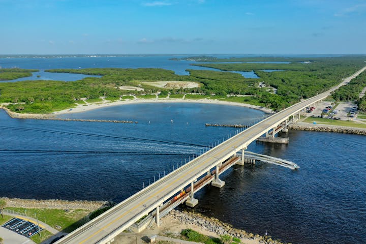
The Sebastian Inlet Channel is the only charted inlet between Cape Canaveral and Fort Pierce and is a local knowledge, fair-weather inlet used largely by smaller recreational fishing boats. A fixed bridge (A1A) crosses the inlet with 39-foot vertical clearance.
Created as an independent special taxing district in 1919 by the Florida State Legislature, the Sebastian Inlet District was chartered to maintain the navigational channel between the Atlantic Ocean and the Indian River.
RESOURCES
- Boating Regulations
- Boating Safety Courses
- Sebastian Inlet Navigation Guide
- Welcome to the Boating and Angling Guide to Brevard County
- Real Time Wind and Wave Data at Sebastian Inlet
- What you need to know about navigation markers on the water
Some text goes here


MARINE ACTIVITIES
Boating is one of the most popular recreational activities for local residents and visitors alike. Sebastian Inlet offers easy offshore access for fishing and diving enthusiasts, and the inshore sand bar is a well-known weekend destination for people looking to enjoy the the area. The direct connection to the Intracoastal Waterway (ICW) enables boaters to explore the entire length of the 156-mile-long Indian River Lagoon, one of the most biologically diverse estuaries in North America.
Kayaking, Stand-Up Paddleboards (SUPs) and other water sports-related activities are also common sights These options afford visitors a chance to experience our natural resources in a unique and intimate way. With multiple launch points within Sebastian Inlet State Park and day rentals available at the state park's marina, residents and visitors can spend a memorable day on the water.
Speed Zones for Boating Safety and Manatee Protection
Area waterways are divided into several speed regulation zones in order to increase boating safety and to minimize manatee injuries resulting from encounters with moving vessels. The Florida Fish and Wildlife Conservation Commission (FWC) sets and enforces speed zones. Signs visible on the water mark the transitions between zones.
Tips to Help Protect Manatees
West Indian manatees are large, gray aquatic mammals. An adult manatee may be almost 10 feet long and weigh 800-1200 pounds. Manatees live in rivers, estuaries, saltwater bays, and canals, and have no natural enemies. However, many deaths result from collisions with watercraft. Manatees are protected under federal and Florida state law. It is unlawful to feed, touch, or disturb any manatee. State penalties are a maximum fine of $500 and/or imprisonment for up to 60 days. A federal penalty may be $100,000 and/or one year in prison.
.jpg?ixlib=rb-1.1.0&w=2000&h=2000&fit=max&or=0&s=dd3a69ff175b8168c77a38dd9a986a32)
To help protect these gentle giants, there are simple things we can all do:
- Be alert while boating and always obey posted speed zone waterway signs.
- Manatees can be hard to spot. Keep a look out for signs of manatees, like a snout breaking the water or a swirl or flat spot in the water caused by a swimming manatee's tail.
- Always wear polarized sunglasses to reduce glare and allow better through-water visibility.
- Slow down. Reducing boat speed gives boaters a better chance to see manatees and avoid them, and gives manatees time to get out of the boat's path.
- Obey posted manatee caution zone signs and avoid manatee sanctuaries.
- Stay in deep water channels as much as possible.
- Remain at least 50 feet away from manatees and stop your prop if you must go closer.
- Stow and properly dispose of your trash. Debris such as discarded plastic bags or six-pack holders is dangerous to manatees and other wildlife. Properly discard or recycle monofilament line and fishhooks.
- Do not feed manatees. It is against the law. Feeding, providing water or touching manatees may encourage them to approach people who might harm them.
Navigation Fast Fact: There are three most common types of navigation - celestial, GPS, and map and compass. Here's the full list:
Pilotage simply means fixing your position with a very high frequency and is used in harbors and restricted waters.
Radio navigation uses radio waves to measure the direction to a radio source. For this to work, you need radio towers all over the place. GPS is winning the battle for sure.
Radar navigation is mostly used to avoid collisions when you're close to land or other ships.
Satellite navigation is the most used form of navigation nowadays. This uses multiple satellites to pinpoint your location.
Celestial navigation is one of the oldest navigation methods. The navigator uses the celestial bodies to determine his location.
With Coastal navigation, the navigator uses the shape of landmarks along the coast, and the direction of the coastline.
With Inertial navigation, you use motion sensors to calculate your new position relative to the starting position. (This is a form of dead reckoning.)
Source: improvesailing.com/navigation