
Summer Bathymetric Survey Ongoing at Sebastian Inlet
Twice a year, the Sebastian Inlet District works with one of its partners at Land & Sea Surveying to complete a comprehensive bathymetric survey, or hydrographic survey, of the entire Inlet system and the beaches 6 miles North and South of the Inlet running into Brevard and Indian River counties.
Bathymetry is the study of underwater depth of lake or ocean floors, the equivalent of topography on dry land. Bathymetric charts show seafloor relief or terrain as contour lines called depth contours. The data used to make bathymetric maps typically comes from an echosounder or sonar mounted beneath or over the side of a boat, “pinging” a beam of sound downward at the seafloor. Today, multi-beam echosounders are used, which use hundreds of very narrow adjacent beams arranged in a fan-like swath ranging from 90 to 170 degrees across. These narrow individual beams provide better accuracy in mapping the seafloor.
This sophisticated technology collects data to produce charts and maps that are essential to the navigation of the Inlet and in assessing the sand volume in the Inlet’s Sand Trap and channel for beach re-nourishment projects and emergency dune repair. Two core responsibilities of the Sebastian Inlet District Commission per its charter. When combined with other data collected through a long-standing partnership with Florida Institute of Technology (FIT), it enables the Sebastian Inlet District to accurately predict sand volume for periodic beach re-nourishment projects after sea turtle nesting season closes.
Teams are currently surveying the 42-acre Sand Trap including the 3,700-foot channel west of the Sand Trap that leads to the Intracoastal Waterway, and 3,000 feet to the north and south on the Indian River Lagoon side. To the east of the Sand Trap, teams are surveying 3,500 feet out from the North Jetty.
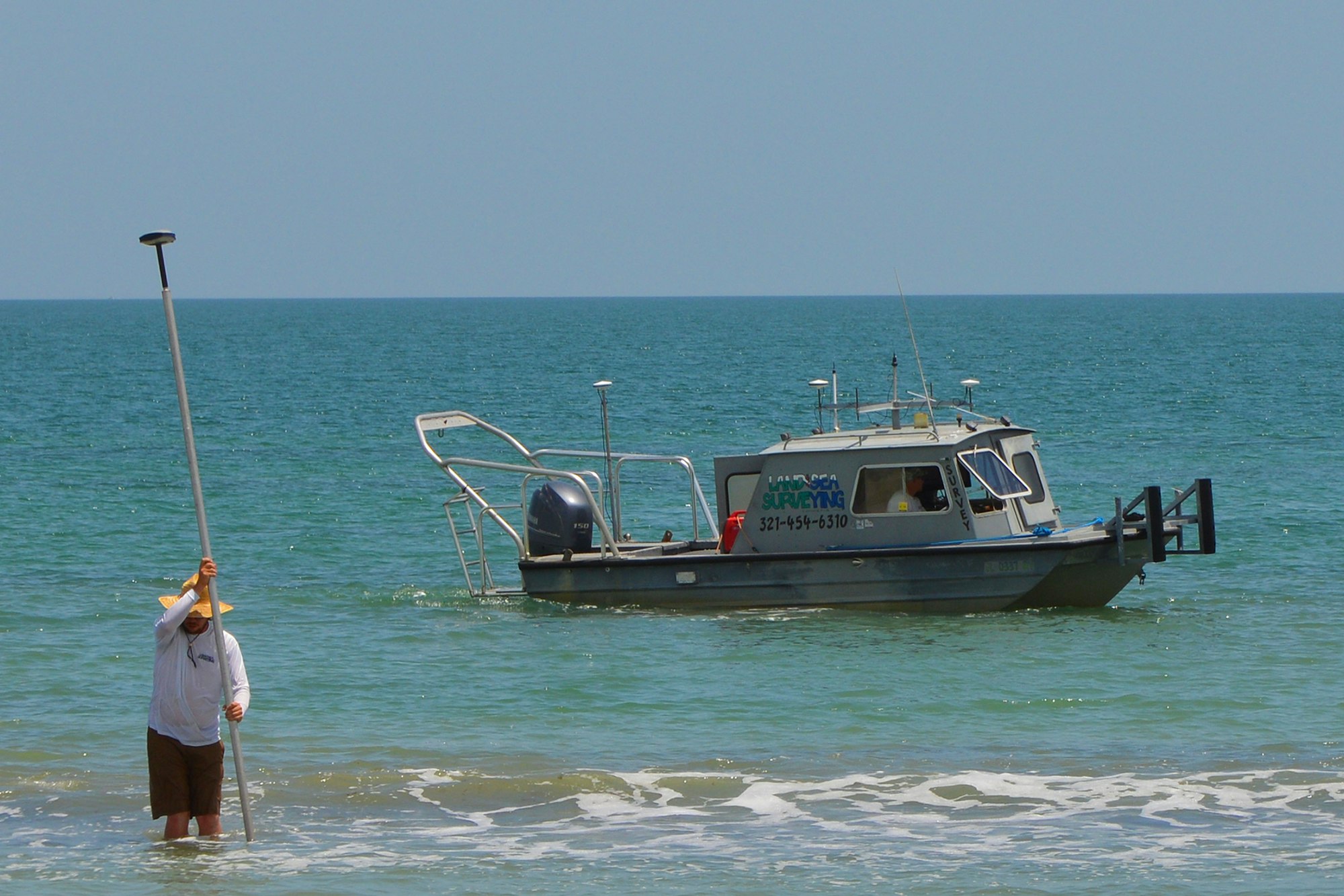
Teams are also deployed on the beach and offshore, surveying from the dune to the surf zone to offshore depths of -40 feet. The area between the surf zone and -8 feet of depth is surveyed with a single beam hydrographic system on a 20-foot Monarch aluminum hull survey boat shown in pictures here. Depths from -8 feet to -40 feet are surveyed using a multi-beam bathymetric system, or the Teledyne Reson Seabat T50 mounted in Land & Sea Surveying’s 25-foot Full Cabin Safe Boat, also pictured. The Seabat T50 is designed for shallow water surveys, and when combined with the Portable Sonar Processor, provides unparalleled survey data, faster operational surveys and reduced processing time. It also allows for faster mobilization on smaller vesssels and has a depth range of 0.5 meters to 450 meters with a swath angel of up to 140 degrees.
The beaches to the north and south of the Inlet are marked with R-monuments representing 1,000-foot intervals, originally placed in the dune and maintained by the Florida Department of Environmental Protection (DEP). In addition to the charts and maps, survey profiles will be created at every R-monument from R-189 to R-219 on the north side of the Inlet in Brevard County, and R-1 to R-30 on the south side into Indian River County. These profiles start at the dune and show depth to -40 feet offshore. For more information, call (321) 724-5175.
The Sebastian Inlet District was created in 1919 as an independent special district by act of the Florida State Legislature, and chartered to maintain the navigational channel between the Atlantic Ocean and the Indian River. The Sebastian Inlet District’s responsibilities have grown to include beach re-nourishment and dune repair as part of a state mandated sand bypass system, erosion control, environmental protection and public safety. The Sebastian Inlet supports a rich and diverse ecological environment that is unparalleled in North America. The Inlet is vital not only to the ecological health of the Indian River Lagoon, but it is also an important economic engine for local communities in the region. Known as the premier surfing, fishing, boating and recreational area on the east coast of Florida, the inlet is one of only five navigable channels that connect the Indian River lagoon to the Atlantic Ocean.
Posted: 8/24/2018