
2024 Seagrass Report: Seagrasses continue to hold their own at Sebastian Inlet
Seagrasses continue to hold their own at Sebastian Inlet. And that’s a good thing.
Seagrass coverage on Sebastian Inlet’s six monitored flood shoals decreased slightly between 2022 and 2024, but losses in some study zones were partially offset by increases in others, according to marine biologists.
Seagrass monitoring in the 145-acre shoal study area dates back to mitigation and seagrass bed protection for the Sebastian Inlet District’s 2007 channel extension project to link the Intracoastal Waterway to Sebastian Inlet with a 3,100-foot marked channel. The six shoals within the study area are located within the Indian River Lagoon, a 156-mile long estuary where seagrasses have struggled to recover following a massive algal bloom in 2011. The Sebastian Inlet shoals are an example of how seagrass recovery progresses over time, says Stephen Trbovich, an AtkinsRéalis marine biologist who leads the annual monitoring project.
“We’ve seen annual fluctuations in seagrass acreage at the inlet’s shoals, but Sebastian Inlet has maintained a general upward trend since the occurrence of the 2011 algal bloom,” Trbovich says. “Despite a slight net acreage loss of seagrass between 2022 and 2024, overall change appears to have been limited and relatively stable for the past four to five years.”
AtkinsRéalis compared the 2024 results to those of 2022 because persistent poor water clarity and unsuitable weather conditions prevented GPI Geospatial, Inc., from capturing aerial images suitable for acreage estimates in 2023. In 2024, seagrass coverage among the six monitored shoals totaled 115.38 acres, an approximate 1.4 percent decrease of 1.64 acres compared to the 117.02 acres mapped in 2022. Three zones (identified in the photos as Zones A, B and D) showed net increases ranging from 0.06 acres (Zone B) to 1.93 acres (Zone D), while net decreases in Zones C, E, and F ranged from 0.53 acres (Zone F) to 2.62 acres (Zone E). Of note is that the gains seen in Zone A were mostly along the west side of the shoal, which experienced significant erosion and was largely barren after 2011, and in Zone D the coverage decrease observed between 2021 and 2022 was largely reversed. Pre-2011 seagrass coverage on the shoals varied between approximately 110 and 115 acres, with some areas showing marked annual changes.
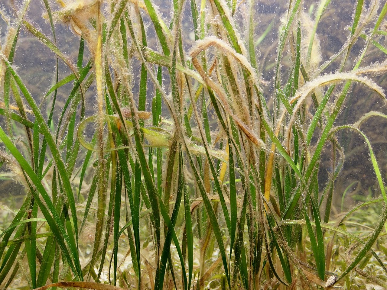
Why do growth patterns of seagrasses at the inlet shoals matter? The shoals are in the Indian River Lagoon, one of the most biologically diverse estuaries in North America. An estuary is any water body where freshwater from the mainland mixes with saltwater (in this case, from the Atlantic Ocean that flows through Sebastian Inlet) creating a brackish water body. Seagrass beds are vital to the health of the 156-mile-long estuary, providing a nursery for juvenile fish, supporting invertebrates like worms, clams and snails, and serving as a food source for creatures that include manatees and sea turtles. Seagrasses also help protect the fragile shoals from erosion caused by wave action and boat wakes; the post-2011 loss of seagrass along the edge of Zone A potentially accelerated the movement of sediment into the inlet channel and sand trap.
Although the District’s main charge is to ensure safe navigation in Sebastian Inlet, the five-member Commission understands the scientific value of seagrass data that spans nearly 20 years.
“We manage Sebastian Inlet based on long-term monitoring and solid science,” says Sebastian Inlet District Vice Chair Lisa Frazier. “We can say with certainty that the seagrass beds near the inlet have returned at a steadier rate than in much of the estuary following the 2011 algal bloom. We share this seagrass data with other agencies and universities to ensure we all gain a better understanding of seagrass trends throughout the estuary. In this way, we can determine potential effects on seagrass growth patterns and diversity.” As an example, researchers from Harbor Branch Oceanographic Institute and Brevard Zoo recently used the District’s seagrass mapping data to collect samples on the inlet flood shoals.
The inlet’s seagrasses have fared better than in some other areas of the lagoon because the Sebastian Inlet provides tidal flushing — and improved water quality for seagrass growth — from the Atlantic Ocean. The four most prolific species of seagrasses in the District’s monitoring zones are shoal grass (Halodule wrightii), Johnson’s seagrass (Halophila johnsonii), paddle grass (Halophila decipiens) and manatee grass (Syringodium filiforme). Of the four, shoal grass and Johnson’s are the dominant species, Trbovich says. “At present the coverage seems stable year-to-year, so what we’re focusing more on is seeing if the flood shoals will return to their pre-2011 composition with dense beds of manatee and shoal grass and how long that takes. We might be seeing slow but promising shifts in that direction; this year we’ll see if that trend continues.”
Fast Facts:
- The District’s 145-acre study area is divided into six zones and contains all the seven different species of seagrasses found in the Indian River Lagoon
- Seagrass growth within the inlet shoals has constantly increased since the lowest point in 2012 except for a period of leveling between 2014 and 2016, when algal blooms once again impacted seagrass growth.
- According to the St. John’s River Water Management District, 2.5 acres of seagrasses can support up to 100,000 fish, up to 100 million invertebrates and $5,000-$10,000 in economic activity.
- Tourism spending generates $953 million annually from the approximately 800,000 visitors engaging in boating and shoreline activities, such as surfing, kayaking and swimming
- Local boaters spend $150 million annually; 15, 689 registered vessels use the inlet
About the Sebastian Inlet District
The Sebastian Inlet District was created in 1919 as an independent special taxing district by act of the Florida State Legislature and chartered to maintain the navigational channel between the Atlantic Ocean and the Indian River. The Sebastian Inlet District’s responsibilities include state mandated sand bypassing, erosion control, environmental protection and public safety. The Sebastian Inlet supports a rich and diverse ecological environment that is unparalleled in North America. The Inlet is vital not only to the ecological health of the Indian River Lagoon, but it is also an important economic engine for local communities in the region. Known as the premier surfing, fishing, boating and recreational area on the east coast of Florida, the inlet is one of only five navigable channels that connect the Indian River lagoon to the Atlantic Ocean.