
Downloadable Bathymetric Charts are Here!
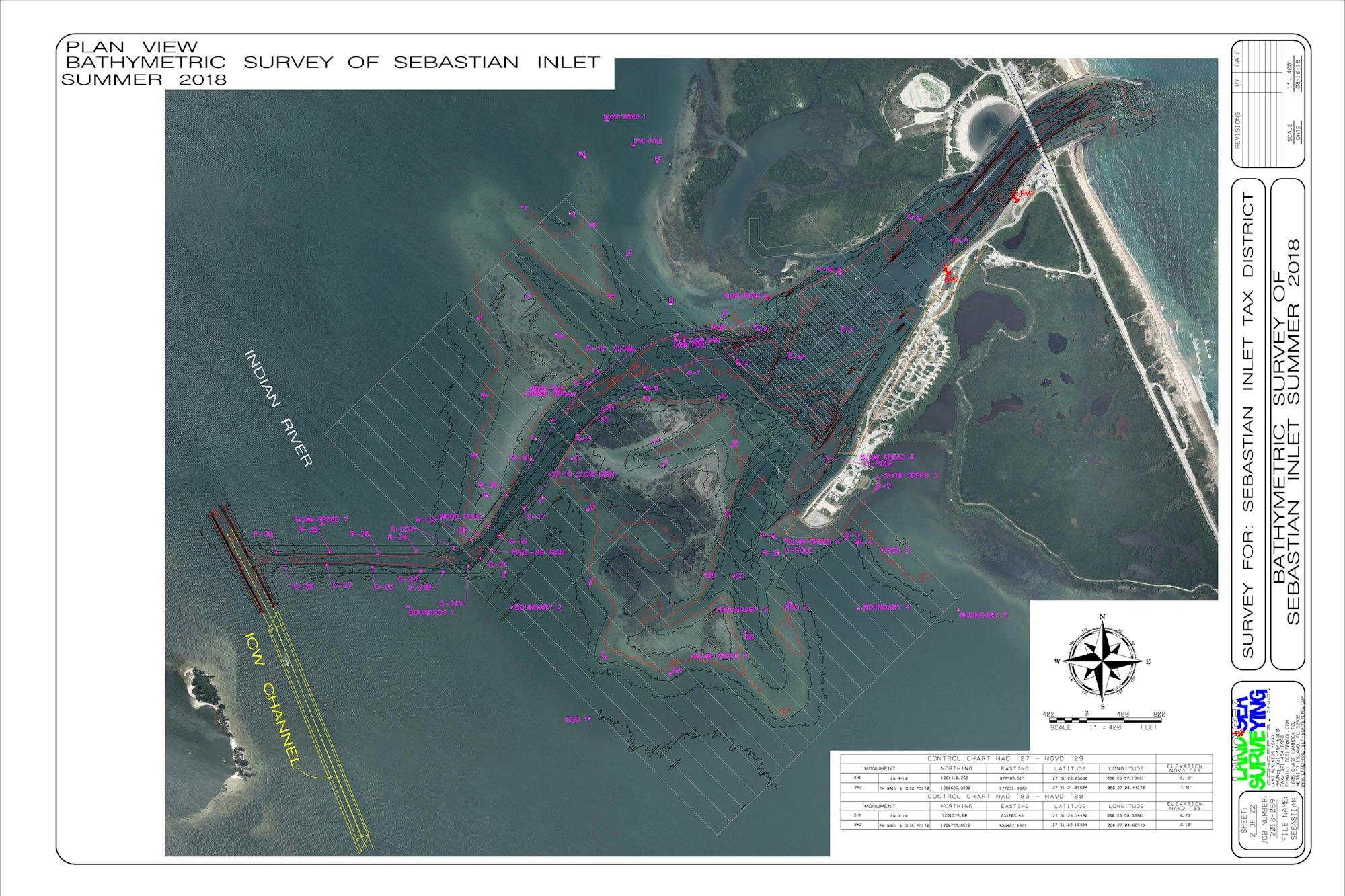
Three weeks ago, we shared that our surveying partners at Land & Sea Surveying were out in the field conducting a comprehensive bathymetric survey of the entire inlet system. Downloadable charts showing water depth are here to aid in the safe navigation of the Sebastian Inlet for all boating, fishing and outdoor recreation enthusiasts!
Sebastian Inlet Bathymetric Chart with contours and markers (PDF)Sebastian Inlet Bathymetric Chart - southern beaches (PDF)For more detail, click here. To request additional information, call (321) 724-5175.
The Sebastian Inlet District was created in 1919 as an independent special district by act of the Florida State Legislature, and chartered to maintain the navigational channel between the Atlantic Ocean and the Indian River. The Sebastian Inlet District’s responsibilities have grown to include beach re-nourishment and dune repair as part of a state mandated sand bypass system, erosion control, environmental protection and public safety. The Sebastian Inlet supports a rich and diverse ecological environment that is unparalleled in North America. The Inlet is vital not only to the ecological health of the Indian River Lagoon, but it is also an important economic engine for local communities in the region. Known as the premier surfing, fishing, boating and recreational area on the east coast of Florida, the inlet is one of only five navigable channels that connect the Indian River lagoon to the Atlantic Ocean.